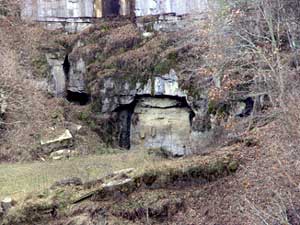
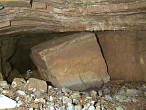
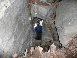
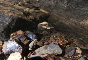
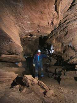
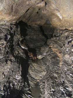
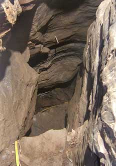
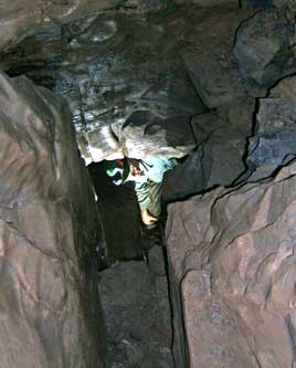
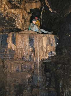
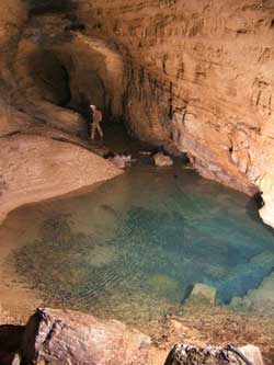
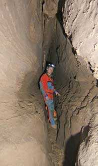
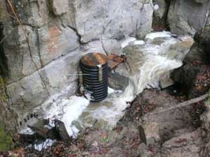
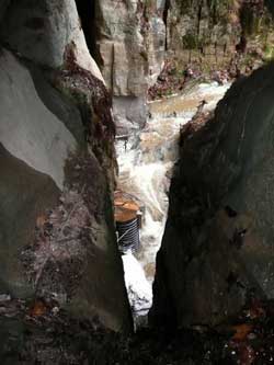
The left photo shows Water Sinks on 23 November 2007, in its normal state. Photo by John Sweet
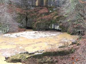
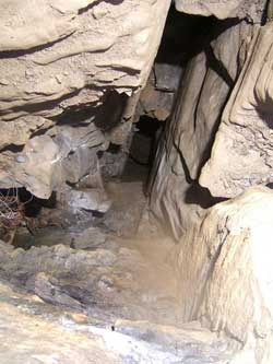
The right photo shows Water Sinks on 16 November 2006, after 2.5" of rain. Photo by Phil Lucas
Last Update: 14 February 2011
|
Water Sinks and all of the caves in and around it belong to Phil and Charlotte Lucas. Exploration and mapping of caves, here and elsewhere, has been Phil’s life-long passion. It has been my privilege to be involved in his Water Sinks project in a modest way. JRS |
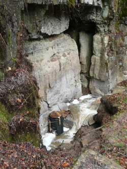
Water Sinks is a huge sinkhole that is shown and named on the Williamsville topographic map. It is dry most of the time but takes a large amount of water after a heavy rain. There are two caves in the Sinks, which are well known and mapped. Both are above stream level and are not involved in carrying away the flood waters. The waters rise and recede without disclosing where they go. Until now.
We had over 3.5 inches of rain in late October 2007. Shortly thereafter landowner Phil Lucas was taking a walk. Let him tell most of the story from here. Text by Phil Lucas except as noted. Edited and assembled from Phil’s e-mails to the BCCS by John Sweet. To be continued!
3 November 2007: Last week while taking a stroll, I noticed that yet another small fissure had opened up in the bottom of the Water Sinks. This is a very dynamic area and it seems like, after every heavy rain, there are changes with new holes opening and others closing. This one was in the very bottom of a 15-foot subsidence that occurred last year. To reach it would require a climb-down through flood debris. Not feeling particularly ambitious, I nearly walked away but tossed a rock out of habit. The rock fell further than I expected. Always the optimist, I climbed down for a closer look. Not only was there a bit of a drop but there was a very noticeable air current (blowing in on a cold day). The fissure was too tight and extended beneath some fearsome looking boulders. Nonetheless, it looked good and produced an echo when I yelled. A few days later, Frank Marks, Cotton Brown, Roger Baroody and I lowered one of Frank’s borehole cameras down the fissure to see what we could see. What we saw looked like a good sized void. Inspired I began making plans and gathering needed materials.
|
|
|
|
The left photo shows Water Sinks on 23 November 2007, in its normal state. Photo by John Sweet | |
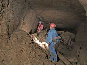
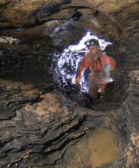
This weekend presented an opportunity. Scott Olson and Mike Spencer were in the cove. I asked them if they would be interested in helping me on this “dig.” They agreed and we spent today using my new generator and a handful of soda straws, making our way down through the fissure. Frank Marks joined us in the afternoon to watch all the goings-on. At 2000 we had it wide enough and hung a 15-foot cable ladder down into the void below. We climbed down. Taking a quick look around, it was instantly clear this was certainly a large cave passage and it echoed off into blackness. Making plans for survey trip tomorrow, we called it quits.
4 November 2007: The Soda-Straw Survey – This morning we got together. Frank Marks came over and suggested that we take one of his borehole cameras with us (with 600 feet of cable on a spool) and video our progress. We agreed and Mike strapped it to his helmet. The technical aspect of this slowed our trip a bit but we were in the cave before noon. Naturally I had my camera and the survey gear. All this did not make for a rapid trip but we did manage to survey 585 feet. We turned around in big passage with plenty of side leads. We named it the Water Sinks Subway.
|
|
|
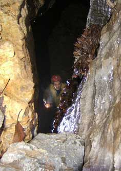
Mike Spencer rigged for video and formations just inside the entrance. Photos by Phil Lucas | |
|
|
|
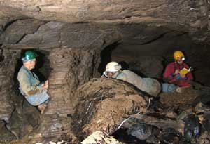
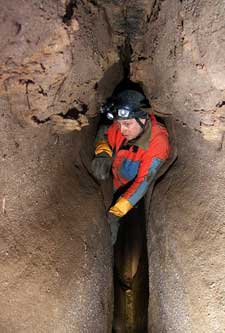
Scott Olson in the main passage during the first day of surveying. Photos by Phil Lucas | |
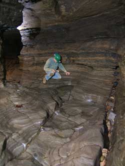
Basically what we surveyed is a big passage that averages 50 feet wide and 20 feet high. It begins at a depth 30 feet below the meadow at the base of the Water Sink cliff. If there was not a meadow there would be a 40-foot wide entrance below the two canyon entrances we now see. The passage extends under the hill to the southwest and under Owl Cave where we turned around. This part of the cave floods big time. The entire floor is washed clean from mud, having mostly rounded breakdown, cobbles, sand and some occasional leaves. There is a fairly steep gradient and we reached a depth of 80 vertical feet below the meadow. There is good airflow, some nice formations and several nice side leads. Phil Lucas to BCCS, e-mail.
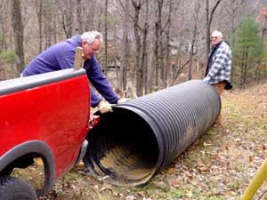
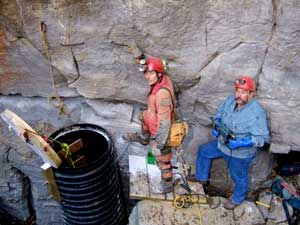
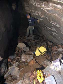
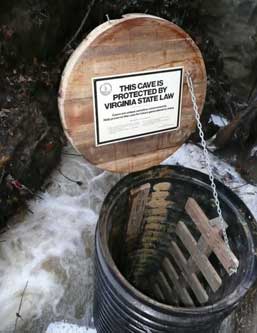
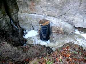
7 November 2007: I went over to help Phil and Frank fetch a culvert to protect the entrance. The idea is to mount it vertically just above the narrow entrance crevice. With a sturdy lid on top it will prevent the crevice from being blocked by debris during future high waters. We dragged the 30" culvert into the sinkhole, then Phil set about further widening the crevice to make access easier. JRS
|
|
|
Frank and Phil with the culvert. The cliff face with cave entrances can be seen through the trees. | |
|
Later the same day there was another survey trip. Here is Phil’s report: Quick Pix Survey – After supper, my son Matt and I descended into the cave and surveyed 501 feet in the first right-hand passage that starts behind the Big Rock. All of these passages were generally small and floored with sand and cobbles. A crawlway at the end of one passage was headed toward the Waterfalls Caves but was not surveyed in favor of bigger passage. This is a good direction to find a northern extension of the cave. Another passage startled Matt when he heard his own heart beating. He had never been in a “heart-beat passage” before and was quite surprised how clear and distinct this sound can become. Yet another passage became a belly crawl and headed up-dip to the northwest. After 150 feet, it seemingly ended in a solid wall. But there was a gentle drift of air flowing into the passage from this “dead-end.” This required crawling all the way to the blank wall. Sure enough, there was a small fissure hidden in the ceiling that was the source of the air flow. Finally we tied into a station from the previous survey to complete our efforts. The photo at left shows Matt in the enlarged entrance fissure. There is only one photo of this trip because I had forgotten to bring a necessary piece of equipment for the photography. Phil
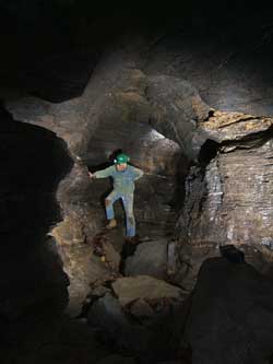
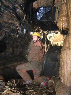
11 November 2007: Another of Phil’s reports – The How-Sweet Survey – Phil Lucas, John Sweet, Gregg Clemmer, Mike Ficco and Scott Olson made up today’s survey party in the Subway. It was not a long trip by Burnsville Cove standards but we did manage to get 951 feet surveyed. This brings the new-passage total to over 2000 feet. We took up where the first survey ended and continued in a downstream direction. The passage, which we named Sweet Dreams, quickly became much smaller. The walls, ceiling and stream bed are all clean-washed and are following the contact between the New Creek and the Keyser Limestones, whose beds are dipping at about 8°. Several smaller side passages branch from Sweet Dreams and follow a parallel down-dip northeast direction. Eventually, the floor of Sweet Dreams becomes covered with sand and cobble and has some leaves scattered along the way. At one point an interesting collection of pine needles coats the floor and walls. Everyone kept saying, “This is not a place to be when it’s raining!” But it wasn’t raining this day and there was no mud — just clean-washed cobbles and sand.
Finally we were reduced to a belly crawl going down-slope to a seemingly dead end. However, there was a gentle breeze blowing through. When pushed, this dead end revealed a lift tube or dry sump where the flood waters had pushed up a 14-foot steep slope of sand and cobbles. At the top was a space with one wall of solid bedrock and the other of breakdown. This appeared to be the side of a sinkhole and later, when I plotted the data, I found it is in the south side of the Water Sinks sink but 180 feet below the present-day floor. This must have been a monster sinkhole. There are two canyons leading from the breakdown. One is small and continues for 40 feet but heads to the northwest (weird direction) while the other will require pulling out some rocks. These leads await some future pushing.
|
|
|
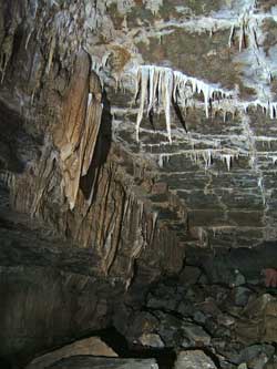
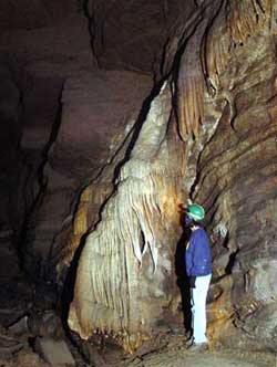
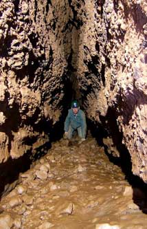
John Sweet in Sweet Dreams. Both of these photos show typical sections of this passage. | |

|
|
|
Surveying the stream passage. Gregg Clemmer, John Sweet, Mike Ficco and Scott Olson, left. | |
|
|
|
The cobble crawl just before the main passage ends. Surveying one of the side passages are John Sweet, Scott Olson and Mike Ficco. | |
The two other side/parallel passages also continued down dip. One ended in a muddy gravelly plug (the only place we saw any mud) and the other led to a sandy belly-crawl that briefly opened into two small canyons. Both of these will require either some serious pushing or enlargement.
As mentioned, the survey totals are 951 feet and the depth has reached 180 feet. There are some digs and some air moving around in this section that will require more investigations. The day was rather warm and the air was not moving very strongly so it will be interesting to see what happens with more extreme temps. I also wondered if, during wetter periods, a stream will be seen flowing down through Sweet Dreams. We shall see. The next survey will begin in one of the three large side leads upstream from this survey. Phil Lucas to BCCS, e-mail.
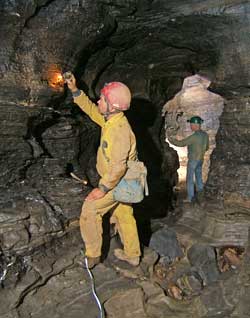
17 November 2007: The Ladder-Rung Trip and Down-Yonder Survey – So far we have been entering the cave using a cable ladder, which is awkward since it hangs against a nearly vertical face. Yesterday morning Jeff Uhl arrived with some re-bar that he had bent for ladder rungs. Rick Lambert, Jeff and I spent a good part of the day drilling holes and pounding in these re-bar rungs to make an easy access down the 19-foot entrance drop into the Water Sinks Subway passage. It worked like a dream. Each rung made ever-increasing-pitch ringing sounds as they were driven home. It sounded a lot like pitons being hammered into a good tight crack. It is a wonderful ladder, so much better than a dangly cable ladder. The entrance is now user friendly. So we declared the task complete and strolled down the Subway for a look-see and a virgin passage to survey.
|
|
|
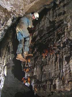
Rick Lambert hammering in a re-bar rung while hanging onto the cable ladder and drilling for another. | |
|
|
|
Rick and Jeff at the entrance and in the newly surveyed passage, one of the few places mud has been encountered so far. The entrance photo shows the culvert in place with its new lid. | |
Turning right at Sweet Dreams we stretched the tape up the sand slope heading south by southeast. Well, the sand soon turned into earthy clay that was covered in earthworm casts by the millions. Hum — I think this ought to be named the Cast-a-Way. Ouch — well that’s its name anyway. No clean-washed rock here but nice passage nonetheless. It goes right underneath Owl Cave but 120 feet below and partway into the slope of Chestnut Ridge. However, as it enters Chestnut Ridge, it is filled with sediment before it reaches the line of big sinks that start at Castle Rocks. At one point we reached an upward sloping passage that ended in a collapse of thin-bedded, cherty/shaley, stuff that might be the same as a three-to-four foot-thick bed of shale that I see on the surface near Castle Rocks. We also encountered a small trickle stream coming in from a thin passage from the northwest. This might be part of the surface stream that sinks around the Castle Rocks area. This stream joined a reasonable-sized passage that flows down to the northeast. We did not follow this stream. In fact, we turned around at this point and headed home with four hundred forty nine feet of survey and leaving five leads. The subway now has 2486 feet of surveyed passages. Thanks Jeff and Rick for all the help on the ladder rungs — we’re now all experts on this technique. Phil Lucas to BCCS, e-mail.
19 November 2007: Brass-Monkey Survey – Frank Marks, Nevin Davis, and I took a short trip into the Subway today and surveyed 407 feet in a rather conspicuous side lead about 400 feet from the entrance. This passage remained large for 150 feet to where a steep slope took the floor up quickly toward the ceiling. At this point I could see a climbable 10-foot fissure into a void above. It seemed to me that I could hear a large echo above and beyond. A belay and some form of protection should be used for this pitch. A single bat was seen on the ceiling — the first bat seen in the cave. There was mud in this passage and worm casts were scattered along the mud floor.
|
|
|
Nevin and Frank in the main passage and Frank at the turnoff to the side lead they are preparing to survey. All four photos in this section are by Phil Lucas | |
|
|
|
Frank Marks in the newly surveyed passage, left, and a red flowstone formation nearby. | |
Backing up we took a side passage we had passed and began to survey again. This nice tube sloped gently up a clean-washed, small-cobble slope. This was another lift tube. The passage then turns southwest again in a nice walking size with sculpted walls. Lead tape Marks called back, “There’s a nice echo ahead and it leads to a drop.” It was somewhat of a surprise that going up a cobblestone slope would lead to a drop but this is indeed the case. With no easy way to climb down, we turned up another slope into another short passage that ended in some colorful goethite formations. This does not seem to be a simple cave! Phil Lucas to BCCS, e-mail.
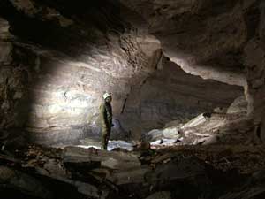
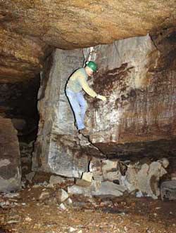
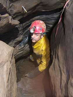
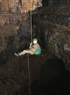
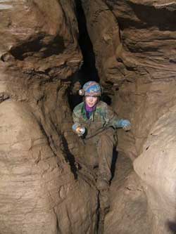
23 November 2007: Phil was out of town for the day when I took our daughter, Kathy Gregg, to see the Subway. She did not have much time so this was just a tourist trip to the cobble crawl near the end of the main passage, with stops for a few photos along the way. JRS
|
|
|
John Sweet on the new ladder Photo by Kathy Gregg | |
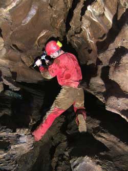
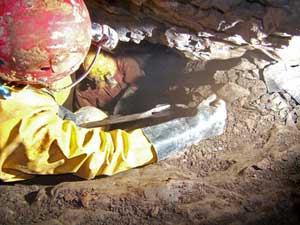
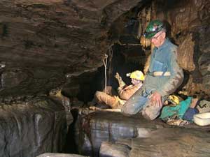
27 November 2007: Back to Phil’s report – The Nick-of-Time Survey – Ben Schwartz came up from Blacksburg (in the nick of time before leaving for Texas) to accompany Nevin Davis and me into the Subway. Ben wanted to collect samples of some mineral crystal that was spotted in the Sweet Dreams Passage and samples of the goethite formations seen during the Brass Monkey Survey. We also planned to do some surveying. Having rained about a half inch the day before, we had some anticipation of encountering surface water flowing in the cave but that was not to be the case. So, with a diminishing threat of rain, we entered the cave and had a fine day.
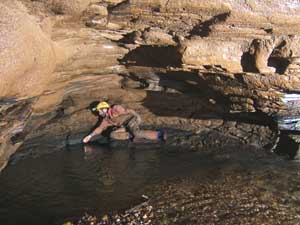
Collecting all the mineral samples went well. With that completed, we investigated the 20-foot deep fissure that we left behind last trip when I had declared to it be unwise to downclimb. Accordingly, we brought a ladder and bolt kit to use for this pitch. Naturally, the first thing Ben did was to climb down the fissure, saying that it wasn’t all that hard. He said there were passages taking off at the bottom and for us to come on down. Naturally, I insisted that since we had the ladder and bolt kit with us that we ought to use them – besides I was going to take some pix anyway (this is always good for five minutes or so – time enough to set a bolt).
Now I need to explain that Ben was carrying a 15-foot ladder and I had a ten-foot cable ladder in my cave pack to use in case the drop was deeper than the 15 foot estimate I had noted in the survey book last trip. It is a nuisance to have a ladder come up five feet short. Well, guess what, the fifteen foot ladder was five feet short. Ben said that we didn’t need that five feet – of course he would say this, after having just climbed back up, gaining five vertical feet with each step. As usual, I forgot about Ben’s long legs and decided to leave the short ladder in my pack. Needless to say, five chin-ups were necessary to climb back up.
|
|
|
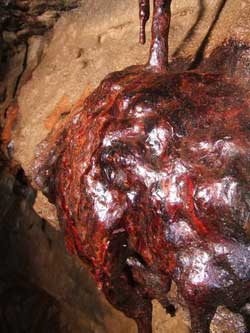
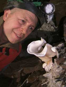
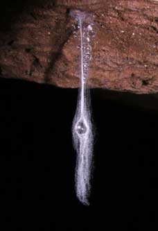
This fungus flower appeared just in the last week, probably growing on fresh debris from the October flood. Benjamin Schwartz setting a bolt for the short-ladder climb. | |
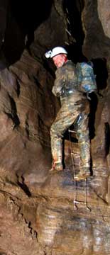
|
|
|
Nevin on the short ladder . . . . . . . . . . . . . . . . . . . . . . . . and Benjamin. | |
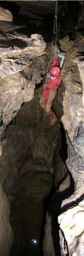
|
|
|
Nevin and Benjamin surveying beyond the short-ladder climb. | |
The passages at the bottom were mostly round tubes with muddy floors. We followed the largest one, a stoop way, down the dipping beds. It continued for over 250 feet, gradually getting somewhat bigger and drier. Eventually we stepped across a number of rimstone dams 2 to 3 feet high (they had been undermined) and reached the point where the passage turned east along the strike. Here, during a quiet survey moment, I heard a stream! Pushing a segment of an old rimstone dam out of the way we came to an intersection that had large stream cobbles scoured clean. Down to the right was a narrow fissure that had the roar of a stream coming from below and beyond.
Though it was tight, Ben managed to continue for another twenty feet or so and yelled back to us that he was at the top of a 30 to 40 foot drop into the top of a large passage (or room). He explained that the walls seemed to be 40 feet to each side and that the sound of rushing water was coming from a large stream flowing through this passage. Whoa Nelly – this was exactly what we have been hoping to find. Could this be the stream coming from Sinking Creek/Better Forgotten or Chestnut Ridge? One problem – we weren’t quite there yet. Even if we could reach the point where Ben had reached, rock anchors and a rope would be necessary for the drop. So while Ben was assessing, I picked out the places where soda straws could provide passage enhancement if this proved to be the only way down. But there might be a better way.
With this discovery, we returned to the main entrance passage to a point not far down from the Big Rock. Here is a nice side lead that obviously takes a lot of water. To enter the side lead is short climb down and, with every trip into the cave, folks have peered down into this good looking canyon. It heads in the direction we had just surveyed. So, we concluded, perhaps this might be a good place to look for an easier access to the stream passage. Sure enough, the stream could be heard coming from a tight fissure on the right wall 40 feet down the passage. The fissure could be followed for a short way and we reached the point where our last survey station could be seen across the top of a very narrow canyon. This was directly above the point where Ben had reached earlier. This approach will be a heck of a lot easier than from the other direction but some soda-straw work for five feet will be needed to adequately widen a tight section in the fissure. So, the Subway continues to have good potential. Today’s survey totaled 393 feet with the Subway’s total now at 3270 feet. Phil Lucas to BCCS, e-mail.
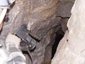
4 December 2007: The Hocus-Pocus Survey – Al Grimm and John Sweet joined me on this effort to tie up some loose ends. We started by surveying a few shots tying the “old cave” to the new Subway. We then spent another few minutes finding a blunder in a short loop off one of the side passages.
With that successfully accomplished, we took my cordless hammer drill and drilled several holes to enlarge the fissure down to the stream that we had heard last trip. The soda straws worked well but two of the drill’s batteries did not hold a charge. I hope to return there with a power cord running from a generator on the surface to run my AC-powered hammer drill. This will be much more effective.
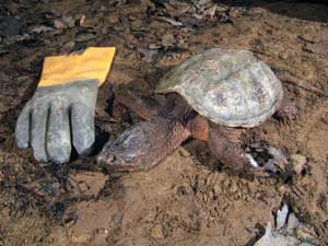
So being out of juice, we headed down to survey a side passage that was missed on the How Sweet Survey. Along the way, Al gives a little whoop and holler that he had almost stepped on a snapping turtle. Sure enough there it was, right out in the middle of the trunk passage as if it had just arrived. We quickly determined that it no longer lived but I don’t think it had been there during our previous trips down this passage. It had not yet begun to smell. I think that perhaps it had entered the cave during the last big rain and had been hanging out in some corner (probably trying to be a bat – a scary one) until recently.
|
|
|
The snapping turtle, at left, and an undercut formation. There is a small passage to the left from which the flowstone originates. The main passage had been half filled with sand and gravel for eons until it was flushed out, leaving the hanging formation. All four photos in this section are by Phil Lucas | |
|
|
|
The tube passage described below, which was surveyed on this trip. | |
Our side lead began as a nice tube about six feet wide and five feet high.In many sections this tube was either washed clean or had banks of sand and cobbles. We followed the passage in an upstream direction. It branched into several smaller tubes, some of which connected to other side passages and some led to a fill. Eventually we came to a place where a lot of large sandstone cobbles were covering the floor. Here I climbed up six feet into a small room with breakdown. From the evidence of washing, the fresher air currents and a slight echo to my scrambling into the room, I sensed we were near something big. I pulled away a couple sticks that were partially blocking my view and looked up through a crack into a black void with booming echoes. This had to be the main passage that we had doubled back upon. My sketch confirmed this looping. I tied a ribbon on a stick in the crack for our return trip back up the main passage to the entrance. Sure enough, walking past the turtle, there was the ribbon in the floor along one wall. We could simply bend over to pick it up. This is yet another reminder that despite our careful observations, key connections might still be overlooked. We came home with 377 feet of new survey and a bunch of other tasks accomplished. Phil Lucas to BCCS, e-mail.
6 December 2007: Chain Gang – Phil Lucas reporting: I’m a bit sore. It all began when I started sweeping the 2 to 3 inches of snow off the 500-foot trail down to the bottom of the Water Sinks at about 0830 this morning. That’s a lot of sweeping but I felt it necessary to help ensure that I would be able to drive my John Deere AMT (a predecessor to the Gator) down the steep hill without crashing and back up again. Despite near zero temps, I was soon sweating. Later, about 1100, Nevin and I drove down safely with the generator in the back of the AMT. After filling and starting the generator, we unreeled 400 feet of cable and started work on the narrow fissure leading down to the roaring creek passage. John Sweet arrived a short time later.
Not much to say about the operation except that hard-rock mining is hard work. We progressed about 20 feet, all with the aid of soda straws and a bunch of holes, some drilled 18 inches deep. All day I kept saying, “When is that generator going to run out of gas?” We finally called it quits about 1900 and retreated. We had gotten to within perhaps three or four feet of where it appears to be opening up but it will probably take a few more shots before allowing entry.
|
|
|
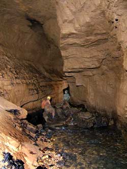
John Sweet emerging from the fissure with the roaring stream. The yellow power cord, faintly visible, leads into the fissure. Nevin Davis entering the fissure, taken from the point where we start to climb down. All four photos in this section are by Phil Lucas | |
|
|
|
The first tight spot that has now been widened. The photo of Nevin, above right, was taken from this point looking back. End of the day’s work, right. This is a bit disorienting but one descends about six feet from the floor shown in the left photo, then one moves about six feet to the left and starts down again in a crevice parallel to the first one. This photo looks down this second crevice at a steep angle. We think [hope] that the passage opens up at the shadowy point in the distance. | |
When we reached the entrance, the air was blowing in like a cold Alberta Clipper. Where is all that air going? The generator was still running – eight plus hours on a tank of gas. TGFA (Thank Goodness For Advil). Phil Lucas to BCCS, e-mail.
9 December 2007: The Touch-and-Go Survey – Mike Ficco, Mike Futrell, Nevin Davis, John Sweet, and Phil Lucas, reporter. Our purpose this day was to gain entry down to the Roaring River, which we have been hearing but not seeing for several trips. Mike Ficco’s new Bosch hammer drill, with its high-impact action, powered by lithium batteries, was the weapon of choice. It sure drills holes fast. Last trip we thought we were close to breaking through. This turned out to be true. With only three straws and the usual rock gardening, we pushed aside the final rubble of rock restrictions! Mike Ficco scooted ahead to the top of the drop and greeted the rest of us with whoops and hollers whose echoes said – big passage!
|
The two Mikes rock gardening at the break- |
|
Mike Futrell at the point where we start to climb down, the | |
|
|
|
John Sweet at the breakthrough, finishing up the last rock moving. Mike Ficco at the jumping off spot, having just set three bolts for the rigging – two main bolts plus a backup. | |
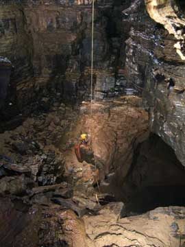
|
|
|
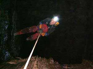
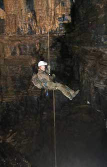
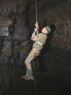
Ficco and Sweet on the ledge with the inevitable clutter of ropes and slings. Phil Lucas on rappel, looking straight down the drop. This photo taken on Phil’s camera by other members of the team. | |
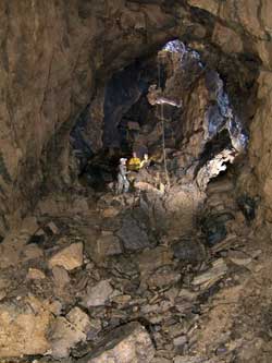
The balcony at the top of a decorated dome was a perfect place for rigging. Mike Ficco had the rock anchors drilled and hangers attached before I could arrive with my camera. That is a sweet and fast drill. Soon the rope was attached and the real fun began.
|
|
|
Sweet and Futrell on the ledge, taken from the top of the scree slope below the drop. | |
|
|
|
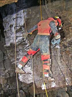
Mike Ficco on rappel, nearing the bottom of the pitch. | |
The drop is beautiful. It is decorated with formations that rim the top of the 20-foot dome. It measured almost exactly 30 feet down to the landing on a steep scree slope that then drops another 16 feet to the shore of a wide Emerald Pool with a large stream passage leading away in the distance. This pool is the source of the Roaring River. It is a deep pool siphon that appears to have a diveable passage heading in a northeasterly direction (toward the entrance of the Water Sinks Cave). Roaring River flows out of the siphon and down a large passage to the southwest (toward the pancake fields). This is a large stream. I would guess that it is half to three quarters the volume of the Aqua stream. So, to those who are familiar with this area, it might be assumed that this is a part, perhaps a major part, of the Burnsville Cove drainage. Certainly, more dye tracing is in order. Furthermore, it might be assumed that Sinking Creek (the surface stream), after it goes underground at the head of the pancake fields, flows down toward the Water Sinks. The streams in the Chestnut Ridge Cave System that are a part of the Aqua drainage are also last seen flowing in a general northeast direction as you would expect. So the Roaring River is flowing in the opposite direction of these assumptions. Obviously, many questions have been raised by this discovery, and there will be a lot of investigations as a result.
|

A closer view of the Emerald Pool, showing |
|
Above left, the Emerald Pool at the bottom of the pit room, source | |
|
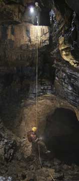
|
|
Nevin on rappel. Ficco and Sweet in the stream passage as we survey downstream. | |
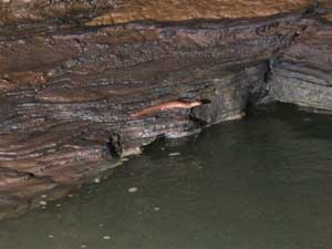
Hmm, I think maybe I have left you hanging as to where the Roaring River Passage goes. This nice big passage, 15 feet wide and 20 feet high, becomes abruptly lower after 230 feet and becomes a deep pool siphon with a salamander guarding the downstream sump. It definitely appears to be diveable. This siphon is the deepest point in the cave so far, 153 feet below the entrance. It is a beautiful section of the cave, well worth the trouble it took to get into it, but we were all disappointed that the stream passage was not a lot longer. This survey added 387 feet, bringing the Subway section to 3971 feet and the entire Water Sinks Cave to 1.21 miles.
|
|
|
Ficco setting the last station at the terminal sump and the salamander guarding it. | |
|
|
|
Mike Ficco on the climb out, while other members of the team await their turns. | |
I took a ton of pix (more than shown here) and everyone displayed extreme patience with me in helping with this part of the process. Thank you again. Phil Lucas to BCCS, e-mail.
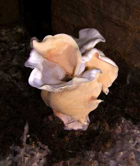
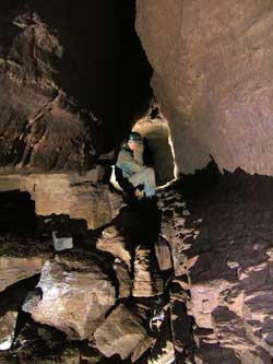
13 December 2007: The Durn-Tootin Survey – Al Grimm, John Sweet, and Phil Lucas, reporter. About two hundred feet inside the Subway entrance where I have taken some pictures of the fungus flowers is a side passage that has been patiently waiting its turn to be explored and surveyed. Today was the day. It is a nicely oval-shaped passage that has the softest floor of a mixture of fine sand, silt, leaves and bit of twigs. I have been wondering where the air is going that pours into the entrance and so when I entered the passage the air current was the first thing I observed. Nope it was not blowing into this passage but blowing out. Not as strong as the entrance but definite air. So, at this point, we still don’t know where most of the air is going.
The passage heads back to the northeast and parallels the entrance passage. After several jogs to the right and left we surveyed the passage to a classic keyhole shape whose narrowness causes some consideration as to how to proceed. Jamming his body into the uppermost space, Al wiggled forward about ten feet until he could drop down into a wider space below. Thousands of fossils sticking out of the walls at this point made the maneuver easier. This would have been a stopper if it had been a muddy tube.
|
|
|
John Sweet at the beginning of the DT survey, where it leaves the main passage. Al Grimm further up the passage. All photos in this section are by Phil Lucas | |
|
|
|
Al in the keyhole passage. John in the short extension of the QP survey, which was part two of our day’s project, described below. | |
From here, the passage makes another right turn and then goes straight for 35 feet to an intersection with a much larger passage with good echoes and the tantalizing air current beckoning onward. Problem was yet another tight place just ten feet short of the intersection. The pinch is about 6 to 7 inches wide and lasts for only four feet. But these four feet will require a couple straws for proper passage enhancement. It sure looked good ahead. The plot of the survey shows that this intersection is 108 feet southeast of the entrance and 60 feet deeper. This is very close to a place where part of surface stream sinks during flooding of the Water Sinks meadow.
Moving along to another hands and knees crawl off the Quick Pix survey, we continued. This passage has a floor of hand-size rounded sandstone cobbles thinly coated by a film of clay-like silt. Apparently only a recent flood has caused this mud coating while earlier floods tumbled the cobbles – interesting. We also noticed another slight air current coming in from this passage. The passage continues for over a hundred feet where in turns down a slope into a too-small tube that will require some cobble removal for further penetration.
Finally we traveled down to the Down Yonder intersection and surveyed a side passage at the top of the sediment slope. Earlier, I had wondered if this was actually a passage and not just a wide spot along the main passage. Well it is a passage that heads to the southwest. And it has a slight air current blowing into the cave. However, in 80 feet it becomes filled with sediment of clay and silt. We could see ahead to larger passage, felt the air in our face but it will require about ten or fifteen minutes of digging to get through.
So far all the cave passages that have air currents bring air into the cave and not out. The only exception is the lift tube in the Sweet Dreams section where moderate air goes away from known cave. We exited the cave and found a light rain falling. This survey added 612 feet for a total of 4594 feet in the Subway section of Water Sinks Cave. Phil Lucas to BCCS, e-mail.
|
The Subway entrance after an inch of rain, above. |
16 December 2007: Water Sinks Creek – The creek is flowing for the first time since late October. Last night a little over once inch of rain fell. Although it was accompanied by a coating of ice, it was needed moisture. This morning I heard the creek flowing over the rapids down in the Sinks so I walked down to see what was happening. The creek had a modest flow (about six inches deep) and was tumbling down around the culvert that we installed some weeks ago. It had ponded about eight feet deep around the culvert. Six feet of the culvert was still above the water but foam sticking to the cliff indicated the water had been a couple feet higher. It seems clear to me that with even a small flood, the culvert is going to be submerged unless another opening into the cave develops (not likely). Lifting the lid, I saw that the culvert was completely empty with the stream rushing down on the outside (mostly on the north side). The two-foot arch I had cut in the side of the pipe at the bottom of the ladder (to make entry into the cave easier) was now a wall of water. There was, I guess, a tenfold increase of the air flow into the cave due, no doubt, to the falling water dragging air with it. With this observation, I am thinking that the culvert will not be filled until the cave is completely flooded. Phil Lucas to BCCS, e-mail.
|
|
|
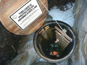
The entrance culvert and ladder, left, and the waterfall at the bottom of the culvert, where one normally goes to enter the cave, right. | |
|
|
|
We are setting up a webcam to monitor the entrance from the spot where the left photo was taken. The right photo is from one of the entrances to the old section of Water Sinks Cave. | |
21 December 2007: The Howdy-Doody Survey – Scott Olson, Gregg Clemmer, Jean Vargas and Phil Lucas, reporter. Entry into the cave today was very interesting because of the 0.9 inch of rain that fell on 15-16 December. This rain caused flooding around the entrance culvert and then poured into the cave, much of it using the same route as we do. In fact, it apparently poured directly down the rebar ladder. Two days later, however, the stream was sinking into its bed before it reached the culvert. Unless the creek changes its course, it would be very difficult to exit the cave since you would be trying to climb directly up a waterfall.
|
|
|
Gregg Clemmer peering up at the ladder coated with leaves and Scott Olson descending the leafy ladder. All photos in this section are by Phil Lucas | |
|
Jean Vargas on the survey crew, above. |
Our trip this day was to survey the side passages off the Down Yonder Survey located southwest of Sweet Dreams. This we did. In doing so, the cave showed us some mud. This area does not get the flushing from flood currents that the Sweet Dreams area gets even though they are not that far apart. The passages we surveyed trend to the northeast and were generally 3 to 4 feet high and 5 to 6 feet wide floored with cobbles and mud banks. Eventually they became lower until they became too low to follow. The passages to the southwest were in-feeders of small trickles that quickly became too narrow. Curious circulating air currents seemed to be present in most all of these passages but none were very strong. At one point the scratch marks of some animal (about the size of a possum) were seen on a wall. Several beetles and millipedes were noticed as well. All in all, this is not going to be a frequently visited area of the cave. We surveyed 521 feet. Phil Lucas to BCCS, e-mail.
|

|
|
Two views of Jean as the cave begins to show its muddier side. | |
23 December 2007: Only 0.4" of rain fell this morning. By afternoon the creek began to flow strongly enough to reach the culvert. Under these conditions the air is really whipping down the pipe and a great roar can be heard from down below, where the stream is making a waterfall. It will be interesting to see what happens when heavy rains bring a flood to the Water Sinks.
|
|
|
The entrance after a moderate rain. Matt Lucas is halfway down the culvert, below the outside pool level, listening to the roar. | |
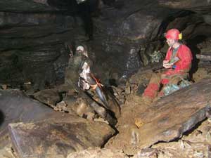
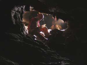
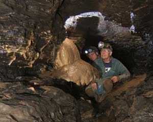
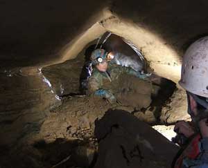
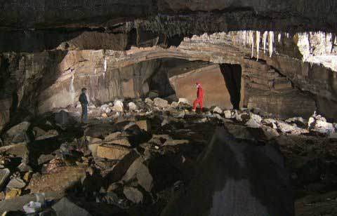
28 December 2007: There was a brief trip into the Subway today to introduce Tommy Shifflett to it and to take a better photo of the entrance room. John Sweet is at left, Tommy in red, and Al Grimm is holding a flash out of the picture to the right. Photo by Phil Lucas. The final event of the year — Happy New Year! JRS
The exploration continues with new discoveries in 2008.
|
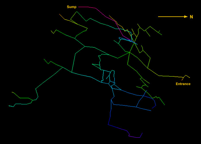
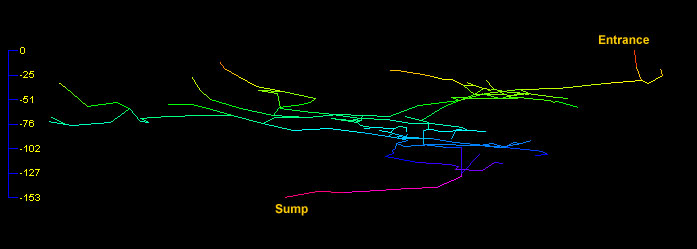
|
Line map of the Subway section of Water Sinks Cave after the 13 December [DT] survey, above, and profile below. The line colors represent different elevations within the cave. |
|
The above maps were produced with Compass cave surveying software. Compass is a share-ware program that is well supported and costs $25 to purchase. Click the above Compass link if you would like to find out more about it and/or download it. If you are running Compass on your computer, you may download the data file for this survey and view it in much more detail. This data file includes the results of the 21 December [HD] survey, which is not shown on the above maps, and will continue to be updated as new surveys are done in 2008 and beyond. Right-click this link and select “Save Link As” or “Save Target As,” depending on your browser. After downloading you must change the filename from 'Subway.txt' to 'Subway.dat' because some manner of error occurs when attempting to download a .dat file. Strange. Happy virtual caving!
J R S

